Intelligent Rover, Safer Mines.
An autonomous, AI-powered rover with thermal imaging, LiDAR-based 3D SLAM, and Wi-Fi HaLow mesh communication — built to navigate GPS-denied underground mines, detect trapped workers, and map hazardous environments in real time.
Real Risks. Real Challenges.
Underground mine accidents in India continue to claim lives every year. These are the challenges that MineX is engineered to solve.
Human Entry into Hazardous Zones
Rescue teams must physically enter collapsed structures, toxic gas pockets, and unstable mine shafts — putting responders at immediate risk.
Limited Visibility Underground
Smoke, dust, and complete darkness in underground mines make visual search nearly impossible for human rescue teams.
Communication Blackouts
Conventional Wi-Fi and cellular signals fail underground. Without reliable communication, coordination between surface and subsurface teams breaks down.
GPS-Denied Navigation
GPS signals cannot penetrate underground — making autonomous navigation, mapping, and location tracking extremely difficult without alternative systems.
Methane & Toxic Gas Exposure
Methane (CH₄), carbon monoxide (CO), hydrogen sulfide (H₂S), and oxygen depletion are constant threats. Manual gas assessment is slow and dangerous.
Slow & Uncertain Search
Manual search operations are time-consuming and can miss survivors in debris. Every minute of delay reduces the chance of survival.
Expensive Existing Solutions
Current mine rescue robots are bulky, costly, and difficult to deploy at scale — making them inaccessible to most mining operations.
Thermal AI · LiDAR SLAM · Wi-Fi HaLow · Autonomous
Autonomous Reconnaissance Before Human Entry
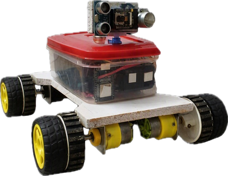
MineX is a ruggedized, autonomous rover designed to perform remote reconnaissance in GPS-denied underground mine environments. Equipped with thermal imaging, LiDAR-based 3D SLAM, and edge AI detection, it provides real-time situational awareness to surface operators — before any human enters the hazardous zone.
Supported by a Wi-Fi HaLow mesh network for reliable underground communication, smart auto-docking for recharging, and auto-retrace capabilities when connectivity is lost — MineX is built for continuous, fault-tolerant operation.
Innovation & Key Features
Thermal + AI Survivor Detection
Faster RescueFLIR Lepton 3.5 thermal camera combined with YOLOv8 (TensorRT) detects trapped workers through heat signatures — even in smoke, dust, and total darkness.
GPS-Free 3D SLAM Mapping
Autonomous Navigation2D RPI LiDAR and MPU-9250 IMU feed into a Pose Graph SLAM pipeline via ROS2 Nav2, enabling real-time 3D tunnel mapping without GPS.
Wi-Fi HaLow Underground Mesh
Always ConnectedIEEE 802.11ah Wi-Fi HaLow creates a self-healing mesh network with relay nodes for long-range, low-power underground communication.
Multi-Gas Hazard Monitoring
Continuous SafetyIndustrial-grade MEMS sensors continuously monitor CH₄, CO, H₂S, and O₃ levels, classifying hazard zones and triggering real-time alerts.
Auto-Retrace & Smart Docking
Mission ResilienceWhen communication is lost, the rover autonomously retraces its path back to the last mesh node. Smart docking enables auto-charging and data transfer.
Dual Platform Mobility
Rover + DroneAll-terrain tank chassis with BLDC motors navigates rough terrain, while a deployable micro drone extends reach into areas the rover can't access.
Purpose-Built Hardware
Ruggedized, modular components selected for underground mine environments.
Inside the MineX Architecture
Built to Keep Running.
Each subsystem runs as an independent, supervised thread. If a sensor fails or short-circuits, the system isolates the fault and auto-restarts it — without impacting any other operation. If communication is lost entirely, the rover auto-retraces its path to the last known mesh node.
Failures are caught and restarted with zero impact on other subsystems. If comms are lost, SLAM Pose Graph recovery retraces the path home.
Everything the Rover Knows. In Real Time.
Sample telemetry data — connect to the rover via Wi-Fi HaLow mesh for live streaming
Ready to Experience Mission Control?
Launch the Command Center dashboard to see live telemetry, thermal + AI vision feeds, 3D SLAM mapping, and full rover control.